Area: 3,849.5 sq. km.
Population: 1,640.9 thousand habitants (2015).
Capital: Bac Giang City.
Districts: Son Dong, Luc Ngan, Luc Nam, Yen The, Lang Giang, Yen Dung, Viet Yen, Tan Yen, Hiep Hoa.
Ethnic groups: Viet (Kinh), Nung, San Chay, San Diu, Hoa, Tay...

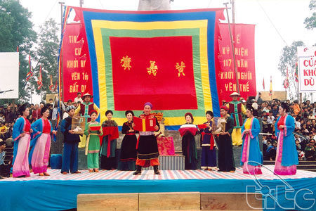
Yen The Festival (Bac Giang Province)
Geography
Bac Giang is located in the north of Vietnam and surrounded by Lang Son in the north, Quang Ninh, Hai Duong and Bac Ninh provinces in the south and south-east, Thai Nguyen Province and Hanoi in the west and north-west.
Its topography includes lowland, midland, and mountainous region. There are many rivers: Cau, Thuong, and Luc Nam rives.
Climate: There are two seasons: the cold and dry season (from October to March next year) and the hot and rainy season (from April to September). The annual average temperature is 24oC.
Tourism
Bac Giang has many beautiful sites and vestiges such as Khe Ro Primitive Forest, Suoi Mo Site, Xuong Giang Ancient Citadel Other interesting sights as Cam Son Lake, Khuon Than Resort.
The province has cultural traditional festival of Kinh Bac people, as well as spring festivals of ethnic groups.
Transportation
Bac Giang is 51km from Hanoi.
Road: There are national highway No. 1A, 31, and 279.
Railway: From Bac Giang to Hanoi, Lang Son, Thai Nguyen, and mineral area in Quang Ninh by train.