Nature inherently keeps many secrets that challenge human curiosity to conquer and discover. In Hoa Tam Commune, Tuy Hoa City, Phu Yen Province, there is a mountain called Da Bia just off National Highway 1A with a large stone jutting straight up off the peak that looks like a “thumbs-up†sign and accounts for this mountain’s nickname, God’s Finger.
About 23km from south Tuy Hoa City and standing over 700m above sea level, Da Bia Mountain is the highest peak of the Ca Pass Mountain Range. The mountain is also well-known as a historical relic. When King Le Thanh Ton ordered his soldiers to cross Cu Mong Pass and head to Ca Pass, the King made a stop here and carved some words on the rock.
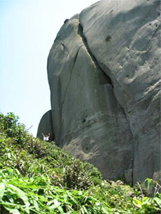
A hike to the top of the mountain and back down again takes about three hours. The pain in the legs is compensated satisfactorily by the splendid surroundings, the amazing feeling of victory and the awesome view capturing everything below.
The stone steps are rather sinuous and some are shaky, so trekkers have to make a good preparation. Sturdy shoes, comfortable clothes, water, bread and tissues to clean up the sweat are essential. As the way is long and tortuous, trekkers should not step fast, but slowly and steadily in order to control heart beats. Long rests do not help as the next start will send the heart beats back to racing speed, so short frequent rests are better.
The path is also scattered with flat sections where tourists can have a seat and a little water to enjoy the surroundings and regain strength. There are many kinds of trees and large rocks that defeat the scorching summer heat of the central region. Wild flowers, butterflies, dragonflies and melodic birds round out this slice of wilderness.
Reaching the top and touching the “thumb†is followed by a heavenly view of Van Phong Bay and Dai Lanh Beach, Ca Pass, Nha Trang City glistening with its numerous islets and Hoa Tam Commune with its red-tiled roofs and waving rice fields.