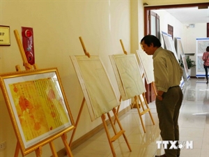
An exhibition of historical evidence proving Viet Nam’s sovereignty over Hoang Sa (Paracel) and Truong Sa (Spratly) archipelagos opened in the northern province of Thai Binh on June 17.

On display are a wide range of ancient maps and atlases, and documents in traditional Chinese, Vietnamese and French languages issued by Vietnamese feudal states and a French researcher from the 15th to the 20th century. All declare Viet Nam’s sovereignty over the two archipelagoes.
Notably, eight maps issued by the Chinese people under the Qing dynasty and the Republic of China are being displayed at the event. Many of the documents, which were announced worldwide in the 16th century, indicate the fact that these islands did not historically belong to China.
Six collections of atlases, selected and issued by Belgian geographer P.Vandermaelen in 1827, show Viet Nam’s sovereignty over both archipelagoes. The exhibition also features a number of official documents from the Nguyen dynasty (1802-1945).
Several art performances and film screenings aimed to encourage the national pride of local people will take place during the two-day exhibition.